
How to Verify Your Products Are Deforestation-Free Under the EUDR
- John Hall
- Customs Specialist at iCustoms.ai
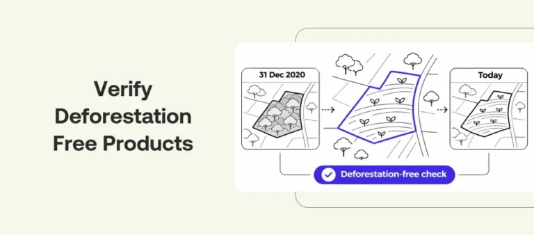
How do you verify your products are deforestation-free? You check every plot of land they came from against what that land looked like on 31 December 2020, and look for forest loss since then. In practice that means valid plot geolocation, a 2020 forest map, a check for change after 2020, and a recorded decision for every plot that raises a flag. This guide covers that verification step only; for the full set of EUDR duties, see our EUDR compliance guide.
What Deforestation-Free Means Under the EUDR
Under Article 2 of the EUDR, deforestation-free products are those produced on land that has not been deforested since 31 December 2020. Wood must also be harvested without causing forest degradation after that date. Forest means land over 0.5 hectares with trees taller than 5 metres and canopy cover above 10%, excluding land mainly in agricultural or urban use. Plantations of cocoa, coffee, oil palm, rubber and soya do not count as forest.
The check looks backwards: was this crop land forest at the cutoff date, and has any forest on it been lost since? A deforestation-free supply chain is one where every plot passes that test.
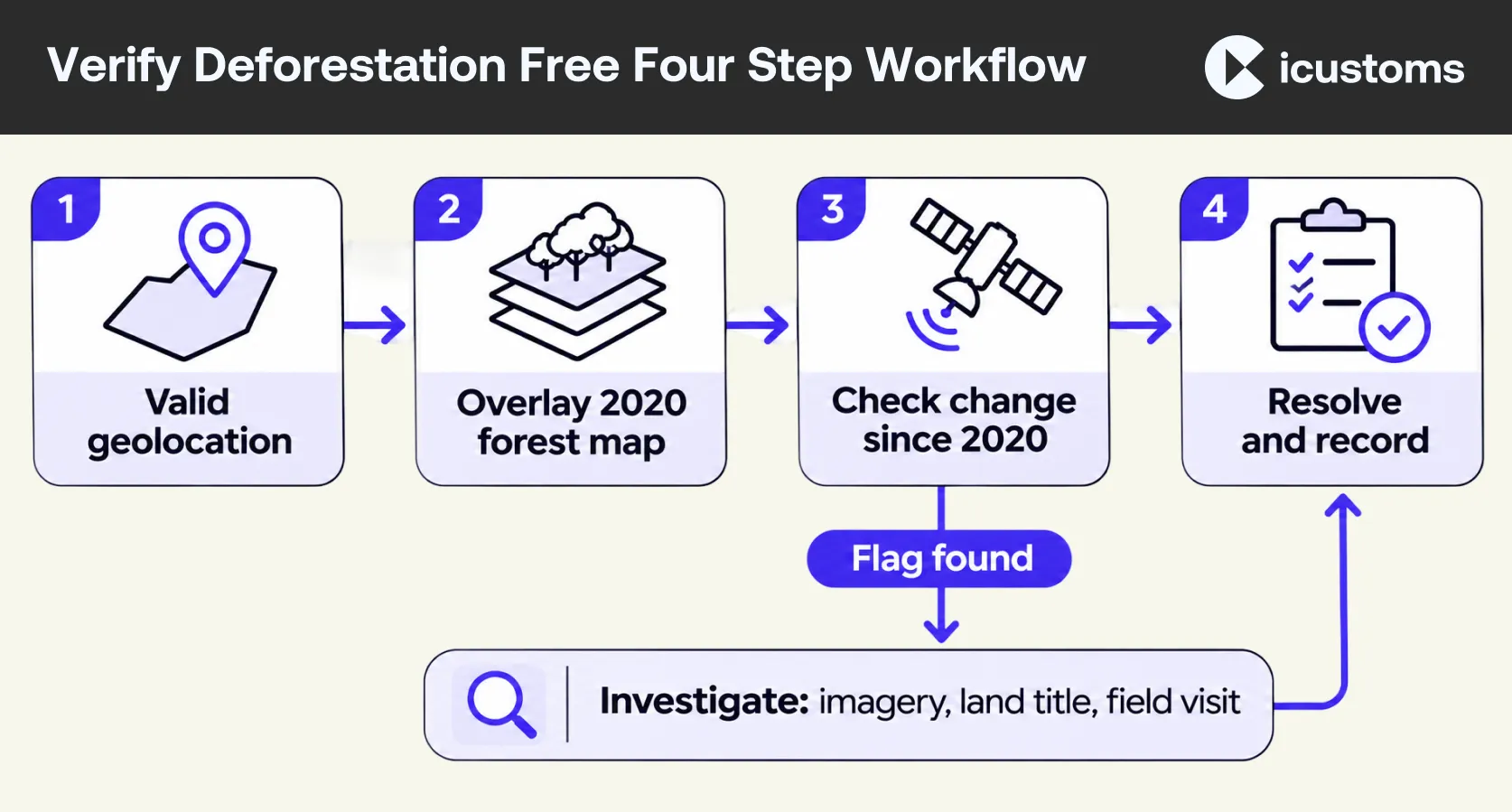
How to Verify Your Products Are Deforestation-Free: A Four-Step Workflow
- Meet the EUDR geolocation requirements for every plot. Points for small plots, polygons for non-cattle plots over four hectares, in GeoJSON. If you cannot get the geolocation of every plot, the product cannot be placed on the market. Our due diligence statement guide sets out the format rules.
- Overlay the plots on a 2020 forest map. The EU Observatory’s Global Forest Cover 2020 map shows forest at 10 metre resolution on the cutoff date; version 3 (December 2025) reports accuracy above 92%. For wood, the Global Forest Types 2020 map helps with degradation.
- Check for change since 2020. This EUDR satellite analysis compares the plots with tree cover loss data and Sentinel-2 or Landsat imagery. Free tools include the JRC’s IMPACT Toolbox, FAO’s WHISP and Global Forest Watch Pro.
- Resolve flags in your EUDR risk assessment and record the decision. For each plot that overlaps forest or shows loss, gather more evidence, such as dated imagery, land titles or a field visit, then record what you found, which sources you used and the date.
What Maps and Certification Can and Cannot Prove
The Commission’s EUDR FAQ is clear on three points. The EU Observatory maps are non-mandatory, non-exclusive and not legally binding: you may use other, more detailed maps. A plot that falls on forest in the 2020 map is a risk signal, not automatic non-compliance. And a plot outside the forest layer is not automatically compliant either, because every map has errors at local scale.
Certifications such as FSC, PEFC, RSPO or Rainforest Alliance can support your EUDR risk assessment, but only as far as it covers the information the EUDR asks for. You still need the plot geolocation, your own checks and your own conclusion. Legality in the country of production must be verified separately.
What an Auditor Will Ask For
- The plot list and GeoJSON files behind each statement.
- Which maps and imagery you used, with dates and versions.
- Every flagged plot, what you checked and how you resolved it.
- Legality evidence for the country of production.
- Who signed off the conclusion, and when.
Keep it for five years, linked to the statement it supports.
How iEUDR by iCustoms Helps
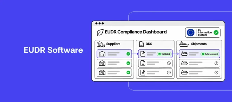
iEUDR handles the first and last steps today. Suppliers enter their plots in the supplier portal, and every point and polygon is validated against the EUDR geolocation rules and converted to GeoJSON before it reaches your DDS. Plot data, supplier evidence and each statement are then kept together in a five-year audit trail. iEUDR does not run satellite analysis today: satellite imagery comparison, as part of risk assessment, is planned for the next phase. See the EUDR compliance software page.
Frequently Asked Questions
How do I check a plot was not deforested after 2020?
Overlay its geolocation on a 2020 forest map, compare it with tree cover loss data or satellite imagery since then, and record the result. Investigate any overlap before concluding, and repeat the check for new plots as part of ongoing EUDR compliance and deforestation monitoring.
Is certification enough to prove deforestation-free status?
No. Certification can support your risk assessment, but you still need plot geolocation and your own documented checks.
Is a plot on the EU forest map automatically non-compliant?
No. It signals a risk that needs further investigation with other sources before you decide.
You may also like:
Plots in. EUDR-Ready

iEUDR validates every point and polygon against the EUDR rules before it reaches your DDS
Subscribe to our Newsletter
About iCustoms
iCustoms is an all-in-one solution helping businesses automate customs processes more efficiently. With AI-powered and machine-learning capabilities, iCustoms is designed to streamline your all customs procedures in a few minutes, cut additional costs and save time.
Satellite checks are coming to iEUDR
Satellite imagery comparison joins iEUDR in the next phase. See the platform today.